Site Information
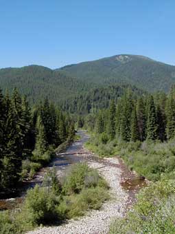
Clearwater Crossing Campground
 Classification: Campground
Latitude: 46.9097°
Longitude: -114.8027°
Elevation: 3490 ft.
Area: Fish Creek
Season Start: Late Spring End: Late Fall
Usage: Medium
Difficulty: Easy
Directions:
20 miles southwest of Fish Creek Exit 66. Follow Fish Creek Road south to W.Fork Fish Cr. Road then W.Fork Fish Creek Road to the end.
Alternate Directions:
37 miles west of Missoula on I-90, take Fish Creek Exit 66. Follow Fish Creek Road #343 south to West Fork Fish Creek Road #7750. Follow Road #7750 to the end.
Attractions and Comments:
Facilities: 3 campsites. Gas within 25 miles. Drinking water, stock facilities and public corrals.
Attractions: Trailhead for Great Burn area. Fishing and hiking.
Fees (no fees required at this campground)
Reservations: None
Open: 6/1-11/30
For more information, contact theNinemile Ranger Station
Facilities: Campsites, Stock facilities, Public corrals, Handicap Nature Tr., Fishing, Hiking
The 7.5 minute series USGS topographic maps for that area
| Landowner Mountain | Lozeau | Tarkio |
| Straight Peak |
Saint Patrick Peak SE | Williams Peak |
| Bruin Hill | Schley Mountain | White Mountain |
Switch to TerraServer - Topo Map
Switch to TerraServer - Aerial Photo(If Avail.)
Switch to Maptech MapServer
Switch to TopoZone MapServer
Switch to TopoWest Quad MapServer